The soils beneath a road embankment in Anchorage can shift dramatically within a single block. In downtown, you might hit dense glacial till with high bearing capacity, while just a mile away in Turnagain, soft marine clays dominate the profile. That contrast means a standard fill design from another region will fail here. We tailor each embankment to its specific subsurface conditions, factoring in the high water table common near Cook Inlet and the freeze-thaw cycles that plague the area. Before placing any fill, we run a soil consolidation test to predict long-term settlement under load. This step is non-negotiable for Anchorage road projects given the compressible clays found along the coastal plain.
Anchorage's unique combination of permafrost-prone silts and seismic shaking makes road embankment design a specialized geotechnical discipline, not a standard fill job.
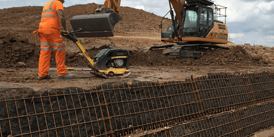
Scope of work
Area-specific notes
During the 1964 Good Friday earthquake, Anchorage saw entire hillsides of fill slide into Ship Creek. That event taught us that seismic stability of road embankments is not optional here. The biggest risk today is liquefaction of loose saturated fills during a magnitude 7+ event. We evaluate this using the Youd-Idriss simplified procedure, comparing SPT blow counts against cyclic stress ratios. Another hidden danger is frost heave in silty fills that trap water. We mitigate it with capillary breaks and free-draining granular layers. Skipping these checks can turn a road into a maintenance nightmare within two winters.
Standards used
ASCE 7-22 Minimum Design Loads for Buildings and Other Structures (seismic loads), IBC 2021 International Building Code (foundation and embankment provisions), ASTM D698-12 Standard Test Methods for Laboratory Compaction Characteristics of Soil, FHWA-NHI-05-037 Mechanistic-Empirical Pavement Design Guide (embankment subgrade)
Linked services
Subsurface Investigation for Embankment Design
We drill test borings to 15–30 m depth, log soil types, and sample for lab testing. SPT blow counts every 1.5 m give us strength profiles, while undisturbed samples assess consolidation behavior. All work follows ASTM D1586 and ASTM D4220.
Embankment Stability Analysis
Using limit equilibrium software (Bishop, Spencer), we compute factor of safety for circular and non-circular slip surfaces. We include seismic coefficient per ASCE 7 and check for deep-seated failure in soft clay layers. Results drive slope design and reinforcement needs.
Settlement and Consolidation Modeling
One-dimensional consolidation tests (ASTM D2435) on undisturbed samples predict primary and secondary settlement. We use Terzaghi's theory with site-specific Cv and Cr values. For thick clay layers, we recommend preloading or vertical drains to meet settlement tolerances within construction timelines.
Typical parameters
Q&A
What is the typical cost range for a road embankment design study in Anchorage?
For a standard highway embankment project in Anchorage, expect a geotechnical investigation and design report to cost between US$1,410 and US$4,740. This includes drilling, lab testing, stability analysis, and settlement calculations. Larger projects with multiple borings or deep soft soil layers fall at the higher end.
How does permafrost affect road embankment design in Anchorage?
Permafrost is present in some hillside areas of Anchorage, especially above 300 m elevation. When warm fill is placed over frozen ground, thawing occurs, causing differential settlement and slope instability. We design with insulated embankments or air convection embankments (ACE) to maintain frozen conditions, following FHWA permafrost design guidelines.
What soil types are most problematic for embankments in Anchorage?
The most troublesome are the Bootlegger Cove Formation clays found in the Turnagain and Government Hill areas. These highly plastic clays (CH) have low undrained shear strength (10–25 kPa) and high compressibility. Silty sands (SM) with high fines content also pose frost heave risks. We always run Atterberg limits and Proctor tests on suspect materials.
How long does a road embankment design study take in Anchorage?
A typical study takes 4 to 8 weeks from field work to final report. Drilling and sampling require 1–2 weeks depending on access. Lab testing for consolidation and strength adds 2–3 weeks. Analysis and report writing take another week. Winter conditions can delay drilling if the ground is frozen deeper than 1 m.