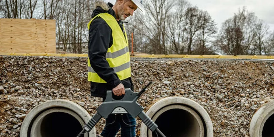
The extreme freeze-thaw cycles of Anchorage, where the mean annual temperature hovers near 35°F and the ground can freeze to depths of 6 feet or more, create a uniquely challenging environment for subsurface imaging. A GPR (Ground Penetrating Radar) survey becomes an essential tool here, as it can detect buried utilities, voids, and anomalous soil layers beneath frost-affected ground without requiring excavation. In a city built on glacial deposits and alluvial fans from the Chugach Mountains, radar penetration depths vary dramatically with moisture content and clay fraction. Engineers often combine GPR data with a resistivity survey to differentiate between frozen and thawed zones, or with [MASW testing](/masw-vs30/) when shear-wave velocity profiles are needed for seismic site classification under ASCE 7. The ability to scan large areas quickly makes the GPR survey a cost-effective first pass before committing to more invasive methods.
In discontinuous permafrost zones of Anchorage, GPR can detect ice-rich layers at depths up to 5 m, guiding foundation design away from thaw-unstable soils.
Scope of work
- Two-way travel time and depth range (typically 0–8 m with 200 MHz antenna)
- Dielectric permittivity of soil layers (calibrated from nearby boreholes)
- Signal attenuation rate to estimate clay/saturation content
- Presence of buried utility conduits, tanks, or debris
Area-specific notes
Anchorage sits at latitude 61.2°N, where permafrost is discontinuous and highly sensitive to warming trends. A GPR (Ground Penetrating Radar) survey is critical for identifying thaw-unstable ground before construction; missing a buried ice lens can lead to differential settlement exceeding 30 cm in a single season. The city's location in a high-seismicity zone (peak ground acceleration of 0.5–0.7g per IBC) also means that loose, saturated sands mapped by GPR may be prone to lateral spreading during an earthquake. Radar data helps prioritize areas for further investigation, such as SPT borings to confirm liquefaction potential, or microtremor HVSR to refine site-specific amplification factors.
Standards used
ASTM D6432-19: Standard Guide for Using the Surface Ground Penetrating Radar Method for Subsurface Investigation, ASCE 7-22: Minimum Design Loads and Associated Criteria for Buildings and Other Structures (Seismic Soil Classification), IBC 2021: International Building Code, Chapter 18 – Soils and Foundations
Linked services
Utility Mapping & Clearance
Locate buried water mains, gas lines, electrical conduits, and communication cables before excavation. We mark targets with paint and provide digital maps compatible with CAD/GIS workflows, reducing strike risk in congested urban rights-of-way.
Permafrost & Ice Lens Detection
Identify discontinuous permafrost bodies, ice wedges, and cryogenic structures in the upper 8 m. Radar profiles are calibrated against thermal boreholes to distinguish frozen from thawed ground, supporting foundation design in sensitive tundra and boreal forest settings.
Stratigraphic Profiling & Voids
Map soil layer boundaries, buried stream channels, and subsurface cavities (natural or man-made). This is particularly useful for landfill expansions, road embankments, and building pads where hidden voids can cause sudden collapse under load.
Typical parameters
Q&A
How deep can GPR penetrate in Anchorage's typical soils?
In dry, sandy glacial outwash deposits, GPR can reach 6–8 m. In silty or clayey soils common near the coast, depth drops to 2–4 m. Frozen ground can improve penetration, but saline pore water in coastal areas severely attenuates the signal. We always calibrate with a nearby borehole or test pit.
What is the typical cost range for a GPR survey in Anchorage?
For a standard utility clearance or small lot assessment (up to 2 acres), expect a range of US$9,490 – US$1,250. Larger infrastructure corridors or permafrost mapping projects often fall at the higher end due to additional data processing and thermal calibration. Contact our office for a project-specific quote.
Does frozen ground affect GPR accuracy for utility detection?
Yes, frozen ground actually improves radar penetration in many Anchorage soils because ice has low electrical conductivity and low dielectric permittivity. However, the presence of ice lenses can create false reflections that mimic utility pipes. Cross-referencing with ground-truthing (e.g., hand auger or potholing) is recommended to avoid misidentification.